The Director of the Ghana Space Science and Technology Institute (GSSTI), Dr. Joseph Tandoh, has called for a shift from discussion to action in the use of satellite and Earth‑observation data to improve the lives of Ghanaians.
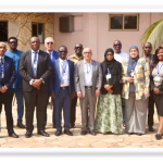
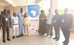
He made the call during the opening ceremony of a two-day multi‑institutional stakeholder engagement organised by the Ghana Space Science and Technology Institute (GSSTI) of the Ghana Atomic Energy Commission in collaboration with Digital Earth Africa (DE Africa) in Accra.
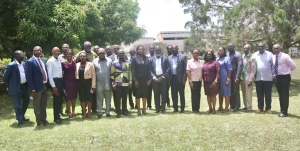
The engagement brought together government agencies, private sector and development partners to explore how satellite data can support agriculture, mining regulation, disaster management, health, and environmental protection.
In his opening remarks, Dr Tandoh noted that the time has come for us to move beyond talk and deliver practical solutions that impact the daily lives of Ghanaians.

“Satellite data should not end on presentation slides. It must be applied to challenges such as agricultural productivity, flood and drought forecasting, coastal monitoring, land administration, and climate resilience” he said.
He explained that this call aligns with Ghana Space Policy, which recognizes space science and Earth observation as strategic tools for development, and emphasizes the need for stronger coordination among government institutions, academia, and research bodies.
Dr. Tandoh mentioned that, as the national institution mandated to coordinate space science activities, GSSTI, is committed to bridging the gap between satellite data access and the computing infrastructure to institutions that need to use the data to generate actionable insights.
“GSSTI cannot do this alone. We need all stakeholders such as ministries, government agencies, academia, and the private sector to work together and develop practical pilot projects that show real value” he emphasized.
Speaking on the practical applications of Earth‑observation data, the Centre Manager of Remote Sensing and Climate Change, Dr. Kofi Asare, highlighted the significant benefits for agriculture and natural resource management.
He stated that satellite‑derived indicators such as soil moisture and vegetation health now make it possible to detect stress on farmlands early.
“The farmer no longer needs to guess. We can identify the exact part of the field with a problem and direct interventions precisely where they are needed” he said.
Dr. Asare noted the growing importance of using satellite data in monitoring and protecting natural resources, especially in mining‑affected areas.
“From sampled data between 2008 and 2024, nearly 60,000 hectares of land has been converted to mining; we can map it, monitor it, and quantify the impact using satellite data and Artificial Intelligence,” he said.
His presentation further highlighted the need to strengthen collaboration within Ghana’s Group on Earth Observations (GhanaGEO) community.
He emphasised the importance of moving from fragmented efforts toward a more coordinated and integrated ecosystem where institutions actively share data and co-develop solutions.
He also stressed the urgent need to transition from decision-making based on perception to one grounded in scientific evidence, noting that satellite-derived data provides a powerful and reliable basis for informed decision-making across sectors.
He further showcased the potential of the Digital Earth Africa platform as a transformative tool for improving access to analysis-ready data and enabling scalable, data-driven applications across agriculture, water resources, urban development, and environmental management.
Contributing to the discussion, the Capacity Development Lead of Digital Earth Africa, Dr. Kenneth Mubea said that Digital Earth Africa provides free, open and accessible Earth‑observation data, enabling governments, researchers and policymakers to carry out high‑quality analysis at national and local levels.
He added that DE Africa’s 30‑year satellite archive helps institutions track environmental change and understand long‑term trends
“The value lies not only in seeing what has changed, but in understanding patterns over time and using that intelligence to guide planning. Our goal at DE Africa is to ensure that satellite data is not locked away in technical systems but applied directly to improve decision‑making,” he explained.
He encouraged the participants to engage actively with DE Africa tools, noting that collaboration and shared access to data are key to improving climate resilience and development across the continent.
Representatives at the engagement included the Water Resources Commission, COCOBOD, Council for Scientific and Industrial Research (CSIR), National Disaster Management Organisation(NADMO), Forestry Commission, Big Data, GhanaMeteorological Agency (GMet) and Ministry of Lands and Natural Resources.
By: CPRC/CCD